Weather ships
Based on wikipedia information and with contribute of R/O Spud ROSCOE (Canada)
A weather ship, or Ocean Station Vessel, was a ship stationed in the ocean for surface and upper air meteorological observations for use in weather forecasting. They were primarily located in the north Atlantic and north Pacific oceans, reporting via radio. The vessels aided in search and rescue operations, supported transatlantic flights, acted as research platforms for oceanographers, monitored marine pollution, and aided weather forecasting by weather forecasters and in computerized atmospheric models.
The idea of a stationary weather ship was proposed as early as 1921 by Météo-France to help support shipping and the coming of transatlantic aviation. They were used during World War II but had no means of defense, which led to the loss of several ships and many lives.

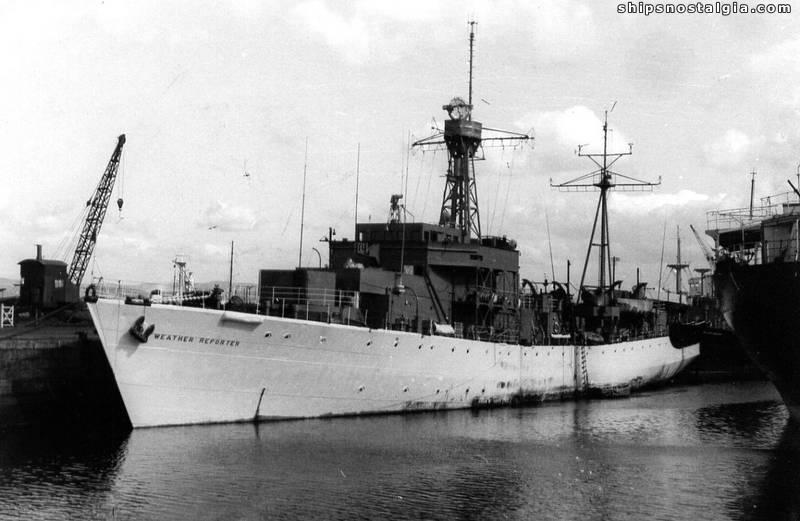
view of operator desk on board vessel “WEATHER REPORTER” c/s MYDN
Weather ship observations proved to be helpful in wind and wave studies, as commercial shipping tended to avoid weather systems for safety reasons, whereas the weather ships did not. They were also helpful in monitoring storms at sea, such as tropical cyclones. Beginning in the 1970s, their role was largely superseded by cheaper weather buoys. The removal of a weather ship became a negative factor in forecasts leading up to the Great Storm of 1987. Weather observations from ships continue from a fleet of voluntary merchant vessels in routine commercial operation (OBS messages).

FAX machinery on board “WEATHER REPORTER” c/s MYDN
The primary purpose of an ocean weather vessel was to take surface and upper air weather measurements, and report them via radio at the synoptic hours of 0000, 0600, 1200, and 1800 Universal Coordinated Time (UTC). Weather ships also reported observations from merchant vessels, which were reported by radio back to their country of origin using a code based on the 16-kilometer (9.9 mi) square in the ocean within which the ship was located. The vessels were involved in search and rescue operations involving aircraft and other ships. By 1982, the ocean weather vessel role had changed too, and the ships were used to support short range weather forecasting, in numerical weather prediction computer programs which forecast weather conditions several days ahead, for climatological studies, marine forecasting, and oceanography, as well as monitoring pollution out at sea. At the same time, the transmission of the weather data using Morse code was replaced by a system using telex-over-radio.

Transmission gears on board “WEATHER REPORTER” c/s MYDN
British weather vessels measured sea temperature and salinity values from the surface down to 3,000 metres (9,800 ft) as part of their duties. Upper air soundings launched from weather ship E (“Echo”) were of great utility in determining the cyclone phase of Hurricane Dorothy in 1966. During 1971, British weather ships sampled the upper 500 metres (1,600 ft) of the ocean to investigate plankton distribution by depth. In 1972, the Joint Air-Sea Interaction Experiment (JASIN) utilized special observations from weather ships for their research. More recently, in support of climate research, 20 years of data from the ocean vessel P (“Papa”) was compared to nearby voluntary weather observations from mobile ships within the International Comprehensive Ocean-Atmosphere Data Set to check for biases in mobile ship observations over that time frame.
73’s
webmaster